| 姓名: | 喬剛 | |
| 性別: | 男 | |
職稱: |
教授 ,博士生導師 | |
籍貫: |
山東淄博 | |
郵箱: |
[email protected] | |
簡介: |
發表中英文學術論文100余篇,其中SCI論文40余篇;主持國家自然科學基金項目5項,國家重點研發計劃項目二級課題4項,國家科技部高端外國專家項目1項,上海市自然科學基金項目1項和國際科技合作項目1項;授權國家發明專利8項,獲國家級教學成果獎二等獎、省部級優秀教學成果獎一等獎和省部級科技進步獎三等獎;國際SCI期刊《Marine Geodesy》助理編輯(2014-);國際冰川學會IGS會員、國際冰凍圈科學學會IACS會員、國際IEEE地球科學與遙感學會會員、美國攝影測量與遙感學會ASPRS會員、南極研究科學委員會SCAR RINGS行動計劃小組成員、國際數字地球學會ISDE中國國家委員會數字極地專業委員會委員、中國冰凍圈科學學會CSCS(籌)極地冰凍圈專業委員會委員,曾任國際攝影測量與遙感學會ISPRS “冰凍圈與水圈”工作組秘書(2016-2022)。本人參加中國第35、36次南極科考,指導的研究生3人參加中國第38、39、40次南極科考,1人參加瑞典北極格陵蘭科考和韓國ARAON多國(瑞典)南極科考(
科考照片和視頻見本頁面底部)。
|
|
學習和工作經歷
研究方向
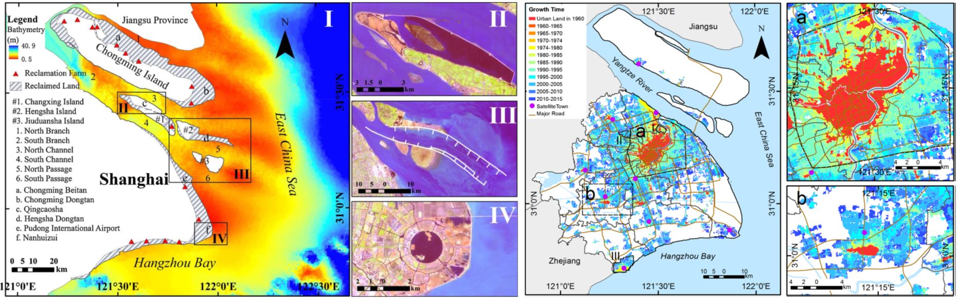
加入我們 歡迎對測繪遙感感興趣的同學加入本課題組攻讀博士和碩士研究生,本課題組正在承擔多個國家級重點項目,可為研究生提供良好的學習與科研環境,以及國際交流和極地考察機會。課題組理念:勤奮、務實、為科研奉獻,促進學生成長。 聯系人:喬剛 電話:13818426779(微信同號) 主講課程 本科生課程:測量學,測量學B,測量實習,測繪VB,測繪編程語言,測繪程序設計與開發,測繪編程實踐,低空無人智能測繪,地理信息系統,地圖學概論 研究生課程:智能測繪研究方法,測繪科學與技術進展,測繪重大工程案例分析,智能測繪與工程案例分析 主要科研項目 1. 國產自主衛星強化觀測技術與全球山地冰川貢獻量估計新方法,國家自然科學基金重大項目“海平面上升的多圈層作用機制與預估”子課題(42394131),2024.01-2028.12,主持 2. 南極冰下湖長時序遙感觀測建模及其對冰蓋物質平衡的影響研究,上海市科技創新行動計劃國際科技合作項目(23230712200),2023.09-2026.08,主持 3. CHINARE地面觀測協同的新型光子測高衛星南極冰蓋變化穩定性方法研究,國家自然科學基金面上項目(42276249),2023.01-2026.12,主持 4. ****工程試驗場****,國家科技部重點研發計劃項目子課題(2022YFC2807105),2022.12-2025.11,主持 5. 全球生態環境遙感監測2023年度報告—南北極與青藏高原冰雪變化及影響,國家遙感中心項目(2022-NRSCC-047),2022.08-2023.12,參加,已結題 6. 南極冰蓋不穩定性過程的國際合作研究,國家科技部外國專家項目(G2022133035L),2022.01-2023.12,主持,已結題 7. 1960年以來雅魯藏布江源區關鍵要素多源遙感觀測與徑流反演,上海市自然科學基金面上項目(22ZR1464700),2022.04-2025.03,主持 8. 冰凍圈表層關鍵過程監測,國家科技部重點研發計劃項目二級課題(2021YFB3900105-3),2021.12-2025.11,主持 9. 星-空多源遙感觀測與海底AUV協同的西南極Thwaites冰川不穩定性研究,國家自然科學基金國際(地區)合作研究與交流項目(42111530185),2021.01-2024.12,主持10. 基于無人機遙感的冰川微地形建模與演化分析——以東南極拉斯曼丘陵區域為例,國家自然科學基金國際(地區)合作研究與交流項目(42011530088),2020.07-2023.06,主持,已結題 11. 南極冰蓋深部結構、冰下過程及其對海平面的影響,國家自然科學基金專項項目(41941006),2020.01-2023.12,課題負責人,已結題 12. 1960年代南極早期衛星影像冰流場重建新方法研究,國家自然科學基金面上項目(41771471),2018.01-2021.12,主持,已結題 13. 研究聲光電磁場景建模與集成方法,國家重點研發計劃項目二級課題(2017YFB0503502),2017.07-2021.06,主持,已結題 14. 長序列多衛星冰川流速監測及產品研發,國家重點研發計劃項目二級課題(2017YFA0603102),2017.07-2022.12,主持,已結題 15. 西南河流源區關鍵水文氣象變量的多源遙感觀測與數據集成,國家自然科學基金重大研究計劃重點項目(91547210),2016.01-2019.12,課題負責人,已結題 16. 特大城市公共基礎設施安全監測技術體系與應急服務,國家測繪地理信息局公益性行業專項項目(201412017),2014.01-2015.12,子課題負責人,已結題 17. 近百年極地冰蓋冰架變化對全球海平面上升的總體貢獻定量研究,國家重大科學研究計劃課題(2012CB957701),2012.01-2016.12,骨干,已結題 18. 集成空天地多源異構多視遙感數據的特大城市超高層建筑物三維重建研究,國家自然科學基金青年項目(41201425),2013.01-2015.12,主持,已結題 19. 極地冰蓋變化多傳感器網絡精密觀測與數據處理關鍵技術,中央高校基本科研預研類項目,2011.01-2013.12,主持,已結題 20. 機載LiDAR輔助的高分辨率衛星立體影像建筑物精確定位與立體提取,同濟大學青年優秀人才培養行動計劃,2011.01-2013.10,主持,已結題 主要學術兼職 國際冰凍圈科學學會IACS會員,2024- 國際數字地球學會ISDE中國國家委員會數字極地專業委員會委員,2023- 南極研究科學委員會SCAR RINGS行動計劃小組成員,2021- 中國冰凍圈科學學會CSCS(籌)極地冰凍圈專業委員會會員,2017- 國際攝影測量與遙感學會ISPRS WG III/9 “冰凍圈與水圈”工作組秘書,2016-2022 國際SCI期刊《Marine Geodesy》助理編輯,2014- 國際冰川學會IGS會員,2013- 國際電氣與電子工程師協會IEEE會員,2012- 國際電氣與電子工程師協會IEEE地球科學與遙感學會會員,2012- 美國攝影測量與遙感學會ASPRS會員,2009- PERS, IEEE TGRS, Survey Review, IEEE JSTARS, IJDE, JOG等多個國際期刊審稿人 指導學生 在讀博士生: 2023級:瞿植 2022級:謝陳雨(參加中國第40次南極科考) 2021級:唐樂月,喬月 2020級:王麗娟(新西蘭奧塔哥大學聯合培養),何正興 2019級:何有權 2018級:袁小涵(瑞典哥德堡大學聯合培養,參加瑞典北極格陵蘭科考和韓國ARAON科考船多國(瑞典)南極科考) 在讀碩士生: 2023級:孫超杰,王奧 2022級:羅鵬瀾,毛瓊瑤 2021級:于承萱,曹哲毅(參加中國第39次南極科考) 畢業碩士研究生及畢業去向: 林 鎧(2020級):漳州市測繪設計研究院 趙浩楠(2019級):北京榮耀終端有限公司 孫子翔(2019級):上海華為技術有限公司 許如國(2018級):南通市自然資源和規劃局 陳樂旻(2017級):黃河勘測規劃設計院 吳藝君(2016級):上海市地震局 曹雨佳(2016級):紹興市自然資源和規劃局上虞分局 李洪偉(2015級):同濟大學讀博(參加中國第38次南極科考) 郭 宋(2014級):當家移動綠色互聯網技術集團有限公司 張 楠(2013級):國網江蘇省電力有限公司經濟技術研究院 畢業博士研究生及畢業去向: 李雁君(2017級,比利時布魯塞爾自由大學聯合培養):中山大學博士后 米 環(2015級,美國波士頓大學聯合培養):煙臺大學任教 主要論文 近期期刊論文: 1. Li, R., Cheng, Y.*, Chang, T., Gwyther, D.E., Forbes, M., An, L.*, Xia, M., Yuan, X., Qiao, G., Tong, X., & Ye, W. (2023). Satellite record reveals 1960s acceleration of Totten Ice Shelf in East Antarctica. Nature Communications, 14, 4061. //doi.org/10.1038/s41467-023-39588-x 2.李榮興*, 夏夢蓮, 謝歡, 郝彤, 喬剛, 劉世杰, 馮甜甜, 田一翔, 安璐*, 童小華, 趙愛國, 李洪偉, 王曉峰, 駱舒蕾, 常甜, 崔浩田, 李國君. (2023). 南極冰蓋物質平衡變化的衛星遙感監測現狀與發展趨勢. 地球物理學報, 66(8): 3115-3143, //doi: 10.6038/cjg2022Q0213 3. Cheng, Y., Hai, G.*, Cui, X.*, Lv, D., Qiao, G., & Li, R.* (2023). Mass balance of the Antarctic Ice Sheet from 2013 to 2018 estimated using the input-output method with updated remote sensing products. Science China Earth Sciences, 66 (7), 1478-1492. //doi.org/10.1007/s11430-022-1109-y 4. Zhao, A, An, L.*, Zhang, Y., Wang, H., Li, F., Feng, T., Hao, T., Hao, W., He, Y., Jiang, L., Lu, P., Meng, X., Niu, X., Qiao, G., Ren, X., Shen, Q., Shen, Y., Tian, Y., Wang, Y., Xiao, B., Xie, H., Zhang, S., Zhou, F., Zhou, S., & Li, R*. (2023). The global change and response special project: using remote sensing data to monitor and invert key components in the cryosphere. All Earth, 35(1), 168-182. //doi.org/10.1080/27669645.2023.2227488 5. Skrypitsyna, T.N., Florinsky, I.V.*, & Qiao, G. (2023). Motion of the D?lk Glacier (Prydz Bay, East Antarctica): Application of unmanned aerial survey. Polar Science, 38(12), 100949. //doi.org/10.1016/j.polar.2023.100949 6. Yuan, X., Qiao, G.*, & Li, Y. (2023). 57-year ice velocity dynamics in Byrd Glacier based on multisource remote sensing data. IEEE Journal of Selected Topics in Applied Earth Observations and Remote Sensing, 16(3), 2711-2727. //doi.org/10.1109/JSTARS.2023.3250759 (2023年卷封面文章) 7. Li, Y., Qiao, G.*, Popov, S., Cui, X., Florinsky, I., Yuan, X., & Wang, L. (2023). Unmanned aerial vehicle remote sensing for Antarctic research. IEEE Geoscience and Remote Sensing Magazine, 11(1), 73-93. //doi.org/10.1109/MGRS.2022.3227056 8. Qiao G.*, Yuan, X., Florinsky, I., Popov, S., He, Y., & Li, H. (2023). Topography reconstruction and evolution analysis of outlet glacier using data from unmanned aerial vehicles in Antarctica. International Journal of Applied Earth Observation and Geoinformation, 117(3), 103186. //doi.org/10.1016/j.jag.2023.103186 9. Feng, T., Li, Y., Wang, K., Qiao, G., Cheng, Y., Yuan, X., Luo, S., & Li, R.*. (2022). A hierarchical network densification approach for reconstruction of historical ice velocity fields in East Antarctica. Journal of Glaciology. 1-20. //doi.org/10.1017/jog.2022.58 10. Hao, T., Cui, H.*, Qiao, G.*, Hai, G., Li, H., He, Y., & Li, R.*. (2022). Impact of slope on ICESat-2 elevation accuracy along the CHINARE route in East Antarctica. IEEE Journal of Selected Topics in Applied Earth Observations and Remote Sensing. 15(7), 5636-5643. //doi.org/10.1109/JSTARS.2022.3189042 11. Qiao G.*, Li, H. (2022). Lake water footprint determination using linear clustering-based algorithm and lake water changes in the Tibetan Plateau from 2002 to 2020. Photogrammetric Engineering & Remote Sensing, 88(6), 371-382. //doi.org/10.14358/PERS.21-00047R2 12. 李榮興, 李國君, 馮甜甜, 沈強, 喬剛, 葉真, 夏夢蓮. (2022). 基于光學遙感衛星影像的南極冰流速產品和方法研究綜述. 測繪學報. 51(6), 953-963. //doi.org/10.11947/j.AGCS. 2022. 20220168 13. 喬剛, 郝彤, 李洪偉, 陸平, 安璐, 陳秋杰, 李榮興*. (2022). 全球氣候變化背景下極地冰蓋關鍵參數遙感觀測驗證. 測繪學報. 51(4), 599-611. //doi.org/10.11947/j.AGCS.2022.20220116 14. Hai, G., Cheng Y., Xie H.*, Hao, T., Qiao, G. & Li, R. 2022. Assessment of CryoSat-2 baseline-D height product by GNSS and ICESat-2 in Lambert-Amery system, East Antarctica. IEEE Journal of Selected Topics in Applied Earth Observations and Remote Sensing, 15(3), 2891-2900. //doi.org/10.1109/JSTARS.2022.3156929 15. Li, R.*, Cheng, Y.*, Cui, H., Xia, M., Yuan, X., Li, Z., & Qiao, G. (2022). Overestimation and adjustment of Antarctic ice flow velocity fields reconstructed from historical satellite imagery. The Cryosphere. 16(2), 737–760. //doi.org/10.5194/tc-16-737-2022 16. Cheng, Y., Xia, M.*, Qiao, G.*, Li, Y., Hai, G., & Lv, D. (2021). Calving cycle of Ninnis Glacier over the last 60 years. International Journal of Applied Earth Observation and Geoinformation, 105(12), 102612. //doi.org/10.1016/j.jag.2021.102612 17. 郝彤, 王曉峰, 馮甜甜, 陸平, 喬剛, 謝歡, 李榮興*. (2021). 地球系統大尺度關鍵過程的智能觀測. 測繪學報. 50(8), 1084-1095. //doi.org/10.11947/j.AGCS.2021.20210109 18. Skrypitsyna, N. T.*, Zakharov, V., Kiseleva, S. A., Bliakharskii, D., Qiao, G., Yuan, X., & Florinsky, I. (2021) Topography evolution of the D?lk outlet glacier (Prydz Bay, East Antarctica) based on data from unmanned aerial surveys performed in 2017–2019. Geodesy and Aerophotosurveying, 65(5), 517–528. //dx.doi.org/10.30533/0536-101X-2021-65-5-517-528 19. Li, R., Li, Z., Han, J., Lu, P., Qiao, G.*, Meng*, X., Hao, T., & Zhou, F. (2021). Monitoring surface deformation of permafrost in Wudaoliang Region, Qinghai–Tibet Plateau with ENVISAT ASAR data. International Journal of Applied Earth Observation and Geoinformation, 104(15), 102527. //doi.org/10.1016/j.jag.2021.102527 20. Cheng, Y., Xia, M.*, Qiao, G.*, Lv, D., Li, Y., & Hai, G. (2021). Imminent calving accelerated by increased instability of the Brunt Ice Shelf, in response to climate warming, Earth and Planetary Science Letters, 572(8), 117132. //doi.org/10.1016/j.epsl.2021.117132 21. Li, R., Li, H., Hao, T.*, Qiao, G.*, Cui, H., He, Y., Hai, G., Xie, H., Cheng, Y., & Li, B. (2021). Assessment of ICESat-2 ice surface elevations over the Chinese Antarctic Research Expedition (CHINARE) route, East Antarctica, based on coordinated multi-sensor observations, The Cryosphere, 15(7). 3083–3099. //doi.org/10.5194/tc-15-3083-2021 22. Jin, S., Liu, Y.*, Fagherazzi, S., Mi, H., Qiao, G.*, Xu, W., Sun, C., Liu, Y., Zhao, B., & Fichot, C. (2021). River body extraction from sentinel-2A/B MSI images based on an adaptive multi-scale region growth method, Remote Sensing of Environment, 255(3), 112297. //doi.org/10.1016/j.rse.2021.112297 23. Mi, H.*, Fichot, C., Bryan, K., Qiao, G.*, & Fagherazzi, S. (2020). Rapid shoreline flooding enhances water turbidity by sediment resuspension: an example in a large Tibetan lake, Earth Surface Processes and Landforms, 45, 3780–3790. //doi.org/10.1002/esp.5000 24. Lu, P., Han, J., Li, Z., Xu, R., Li, R., Hao, T., & Qiao, G.* (2020). Lake outburst accelerated permafrost degradation on Qinghai-Tibet Plateau, Remote Sensing of Environment, 249(11), 112011. //doi.org/10.1016/j.rse.2020.112011 25. Qiao, G.*, Li, Y., Guo, S., & Ye, W. (2020). Evolving instability of the Scar Inlet Ice Shelf based on sequential Landsat images spanning 2005–2018. Remote Sensing, 12(1), 36. //doi.org/10.3390/rs12010036 26. Lu, P., Han, J., Hao, T.*, Li, R.*, & Qiao, G. (2020). Seasonal deformation of permafrost in Wudaoliang basin in Qinghai-Tibet Plateau revealed by StaMPS-InSAR. Marine Geodesy, 43(3), 248-268. //doi.org/10.1080/01490419.2019.1698480 27. Mi, H., Fagherazzi, S., Qiao, G.*, Hong, Y., & Fichot, G.* (2019). Climate change leads to a doubling of turbidity in a rapidly expanding Tibetan Lake, Science of the Total Environment, 688, 952-959. //doi.org/10.1016/j.scitotenv.2019.06.339 28. Mi, H., Qiao, G.*, Wang, W., & Hong, Y. (2019). Analysis of urban growth from 1960 to 2015 using historical DISP and Landsat time series data in Shanghai. Arabian Journal of Geosciences, 12(7), 250. //doi.org/10.1007/s12517-019-4420-2 29. Cui, X., Liu, J., Tian, Y.*, Sun, B., Li, R.*, Markov, A., Lv, D., Hai, G., Qiao, G., Feng, T. (2019). GIS-supported airfield selection near Zhongshan Station, East Antarctica, based on multi-mission remote sensing data. Marine Geodesy, 42(5), 422-446. //doi.org/10.1080/01490419.2019.1645770 30. Qiao, G., Mi, H., Wang, W.*, Tong, X.*, Li, Z., Li, T., Liu, S., & Hong, Y. (2018). 55-year (1960–2015) spatiotemporal shoreline change analysis using historical DISP and Landsat time series data in Shanghai. International Journal of Applied Earth Observation and Geoinformation, 68, 238-251. //doi.org/10.1016/j.jag.2018.02.009 31. Tong, X.*, Liu, S., Li, R., Xie, H., Liu, S., Qiao, G., Feng, T., Tian, Y., & Ye, Z. (2018). Multi-track extraction of two-dimensional surface velocity by the combined use of differential and multiple-aperture InSAR in the Amery Ice Shelf, East Antarctica. Remote Sensing of Environment, 204, 122-137. //doi.org/10.1016/j.rse.2017.10.036 32. Huang, Q., Long, D.*, Du, M., Zeng, C., Qiao, G., Li, X., Hou, A., & Hong, Y. (2018). Discharge estimation in high-mountain regions with improved methods using multisource remote sensing: A case study of the Upper Brahmaputra River. Remote Sensing of Environment, 219, 115-134. //doi.org/10.1016/j.rse.2018.10.008 33. Li, R.*, Ye, W., Qiao, G.*, Tong, X., Liu, S., Kong, F., & Ma, X. (2017). A new analytical method for estimating Antarctic ice flow in the 1960s from historical optical satellite imagery. IEEE Transactions on Geoscience and Remote Sensing, 55(5), 2771-2785. //doi.org/10.1109/TGRS.2017.2654484 (2017年5月期封面文章) 34. Ye, W., Qiao, G.*, Kong, F., Ma, X., Tong, X., & Li, R. (2017). Improved geometric modeling of 1960s KH-5 ARGON satellite images for regional Antarctica applications. Photogrammetric Engineering & Remote Sensing, 83(7), 477-491. //doi.org/10.14358/PERS.83.7.477 35. Feng, D., Liu, Y.*, Gao, Y., Zhou, J., Zheng, L., Qiao, G., Ma, L., Lin, Z., & Grathwohl, P. (2017). Atmospheric bulk deposition of polycyclic aromatic hydrocarbons in Shanghai: Temporal and spatial variation, and global comparison. Environmental Pollution, 230, 639-647. //doi.org/10.1016/j.envpol.2017.07.022 36. Qiao, G.*, Mi, H., Feng, T., Lu, P., & Hong, Y. (2016). Multiple constraints based robust matching of poor-texture close-range images for monitoring a simulated landslide. Remote Sensing, 8(5), 396. //doi.org/10.3390/rs8050396 37. He, X.*, Hong, Y.*, Vergara, H., Zhang, K., Kirstetter, P. E., Gourley, J. J., Zhang, Y., Qiao, G., & Liu, C. (2016). Development of a coupled hydrological-geotechnical framework for rainfall-induced landslides prediction. Journal of Hydrology, 543, 395-405. //doi.org/10.1016/j.jhydrol.2016.10.016 38. Feng, T., Mi, H., Scaioni, M., Qiao, G., Lu, P., Wang, W., Tong, X., & Li, R*. (2016). Measurement of surface changes in a scaled-down landslide model using high-speed stereo image sequences. Photogrammetric Engineering & Remote Sensing, 82(7), 547-557. //doi.org/10.14358/PERS.82.7.547 39. Lu, P., Wu, H.*, Qiao, G., Li, W., Scaioni, M., Feng, T., Liu, S., Chen, W., Li, N., Liu, C., Tong, X., Hong, Y., & Li, R. (2015). Model test study on monitoring dynamic process of slope failure through spatial sensor network. Environmental Earth Sciences, 74(4), 3315-3332. //doi.org/10.1007/s12665-015-4369-8 40. Scaioni, M., Feng, T.*, Barazzetti, L., Previtali, M., Lu, P., Qiao, G., Wu, H., Chen, W., Tong, X., Wang, W., & Li, R. (2015). Some applications of 2-D and 3-D photogrammetry during laboratory experiments for hydrogeological risk assessment. Geomatics Natural Hazards and Risk, 6(5-7), 473-496. //doi.org/10.1080/19475705.2014.885090 近期國際會議論文: 1. Tang, L., Lin, K., Xie, C., & Qiao, G*. (2023). Grounding line mapping with differential Synthetic Aperture Radar Interferometry: A case study on the coast of Dronning Maud Land, East Antarctica. 2023 SAR in Big Data Era (BIGSARDATA), 1-4. //doi.org/10.1109/BIGSARDATA59007.2023.10294824 2. Yu, Z., Cao, Z., Yu, C., Qiao, G.*, & Li, R.* (2022). Ice flow velocity mapping in Greenland using historical images from 1960s to 1980s: scheme design. International Archives of the Photogrammetry, Remote Sensing & Spatial Information Sciences. XLIII-B3-2022, 799-804. //doi.org/10.5194/isprs-archives-XLIII-B3-2022-799-2022 3. Ge, S., Cheng, Y.*, Li, R.*, Cui, H., Yu, Z., Chang, T., Luo, S., Li, Z., Li, G., Zhao, A., Yuan, X., Li, Y., Xia, M., Wang, X., & Qiao, G.* (2022). Analysis of overestimation in historical ice flow velocity maps in Western Pacific Ocean Sector, Antarctica. International Archives of the Photogrammetry, Remote Sensing & Spatial Information Sciences. XLIII-B3-2022, 757–763, //doi.org/10.5194/isprs-archives-XLIII-B3-2022-757-2022 4. Lin, K., Qiao, G.*, Zhang, L., & Popov, S. (2022). Extraction of ice flow velocity by combination of DInSAR and offset tracking methods for Pine Glacier, West Antarctica. International Archives of the Photogrammetry, Remote Sensing & Spatial Information Sciences. XLIII-B3-2022, 765-770. //doi.org/10.5194/isprs-archives-XLIII-B3-2022-765-2022 5. Wang, L., Qiao, G.*, Florinsky, I V, & Popov, S. (2022). Landfast iceberg height retrieval and evaluation based on remote sensing approaches in Antarctica. International Archives of the Photogrammetry, Remote Sensing & Spatial Information Sciences. XLIII-B3-2022, 785-791. //doi.org/10.5194/isprs-archives-XLIII-B3-2022-785-2022 6. He, Y., Qiao, G.*, Li, H., Yuan, X., & Li, Y. (2021). Unmanned aerial vehicle derived 3D model evaluation based on ICESat-2 for ice surface micro-topography analysis in East Antarctica. International Archives of the Photogrammetry, Remote Sensing & Spatial Information Sciences. XLIII-B3-2021, 463–468, //doi.org/10.5194/isprs-archives-XLIII-B3-2021-463-2021 7. Zhao, H., Xu, R., & Qiao, G.* (2021). Comparison of CryoSat-2 and ICESat-2 on water level monitoring of Nam Co lake.International Archives of the Photogrammetry, Remote Sensing & Spatial Information Sciences. XLIII-B3-2021, 527–532, //doi.org/10.5194/isprs-archives-XLIII-B3-2021-527-2021 8. Sun, Z., & Qiao, G.* (2021). A review of surge-type glaciers. International Archives of the Phtogrammetry, Remote Sensing & Spatial Information Sciences. XLIII-B3-2021, 503–508, //doi.org/10.5194/isprs-archives-XLIII-B3-2021-503-2021 9. Luo, S., Cheng, Y., Li, Z., Wang, Y., Wang, K., Wang, X., Qiao, G., Ye, W., Li, Y., Ma, X., Yuan, X., Tian, Y., Tong, X., & Li, R.* (2021). Ice flow velocity mapping in East Antarctica using historical images from 1960s to 1980s: recent progress. International Archives of the Photogrammetry, Remote Sensing & Spatial Information Sciences. XLIII-B3-2021, 491–496, //doi.org/10.5194/isprs-archives-XLIII-B3-2021-491-2021 10. Li, Y., Qiao, G.*, & Yuan, X. (2021). Observations of continuous instability for Scar Inlet Ice Shelf, Antarctic Peninsula. International Archives of the Photogrammetry, Remote Sensing & Spatial Information Sciences. XLIII-B3-2021, 485–490, //doi.org/10.5194/isprs-archives-XLIII-B3-2021-485-2021 11. Cui, H., Li, R.*, Li, H., Hao, T., Qiao, G., He, Y., Hai, G., Xie, H., Cheng, Y., & Li, B. (2021). Field validation of ICESat-2 data along CHINARE route in east Antarctica. International Archives of the Photogrammetry, Remote Sensing & Spatial Information Sciences. XLIII-B3-2021, 443–448, //doi.org/10.5194/isprs-archives-XLIII-B3-2021-443-2021 12. Yuan, X., Qiao, G.*, Li, Y., Li, H., & Xu, R. (2020). Modelling of glacier and ice sheet micro-topography based on unmanned aerial vehicle data, Antarctica, International Archives of the Photogrammetry, Remote Sensing & Spatial Information Sciences., XLIII-B3-2020, 919–923, //doi.org/10.5194/isprs-archives-XLIII-B3-2020-919-2020. 13. Cheng, Y., Li, X., Qiao, G.*, Ye, W., Huang, Y., Li, Y., Wang, K., Tian, Y., Tong, X., & Li, R.* (2019). Ice flow velocity mapping of East Antarctica from 1963 to 1989. International Archives of the Photogrammetry, Remote Sensing & Spatial Information Sciences. XLII-2/W13, 1735-1739, //doi.org/10.5194/isprs-archives-XLII-2-W13-1735-2019 14. Xu, R., Qiao, G.*, Wu, Y., & Cao, Y. (2019). Extraction of rivers and lakes on Tibetan Plateau based on Google Earth Engine. International Archives of the Photogrammetry, Remote Sensing and Spatial Information Sciences, XLII-2/W13, 1797-1801, //doi.org/10.5194/isprs-archives-XLII-2-W13-1797-2019 15. Tian, Y.*, Xia, M., Li, X., Qiao, G., & Li, R. (2019) Applications of historical optical DISP images in Antarctica study. IGARSS 2019 - 2019 IEEE International Geoscience and Remote Sensing Symposium, Yokohama, Japan, 2019, pp. 3994-3997, //doi.org/10.1109/IGARSS.2019.8900380 16. Chen, L., Hao, T.*, Qiao, G., Lu, P., & Li, R. (2019). Using multi-years MODIS LST Data to monitor the ground surface freezing and thawing conditions on the Qinghai-Tibet Plateau. 2019 10th International Workshop on the Analysis of Multitemporal Remote Sensing Images (MultiTemp), Shanghai, China, 2019, pp. 1-4, //doi.org/10.1109/Multi-Temp.2019.8866955 17. Liu, J., Cui, X., Tian, Y.*, Sun, B., Markov, A., Lv, D., Hai, G., Qiao, G., Feng, T., & Li, R. (2019). Feasibility analysis of airfield selection based on multi-temporal and multi-mission remote sensing data. In 2019 10th International Workshop on the Analysis of Multitemporal Remote Sensing Images (MultiTemp). pp. 1-4. IEEE. //doi.org/10.1109/Multi-Temp.2019.8866931 18. Zhang, X., Qiao, G., & Scaioni, M.* (2018). Evaluation of 3D reconstruction accuracy in the case of stereo camera-pose configuration. New Advanced GNSS and 3D Spatial Techniques, 177-187. //doi.org/10.1007/978-3-319-56218-6_14 19. Li, X., Li, R., Qiao, G.*, Cheng, Y., Ye, W., Gao, T., Huang, Y., Tian, Y., & Tong, X. (2018). Compiling techniques for East Antarctic ice velocity mapping based on historical optical imagery. International Archives of the Photogrammetry, Remote Sensing and Spatial Information Sciences - ISPRS Archives 42(3), 2625-2628. //doi.org/10.5194/isprs-archives-XLII-3-2625-2018 20. Li, H., Qiao, G.*, Wu, Y, Cao, Y., & Mi, H. (2017) Water level monitoring on Tibetan lakes based on ICESat and ENVISat data series. International Archives of the Photogrammetry, Remote Sensing & Spatial Information Sciences. XLII-2/W7, 1529–1533, //doi.org/10.5194/isprs-archives-XLII-2-W7-1529-2017 21. Li, R.*, Ma, X., Cheng, Y., Ye, W., Guo, S., Tang, G., Wang, Z., Gao, T., Huang, Y., Li, X., Qiao, G., Tian, Y., Feng, T., & Tong, X. (2017). Ice velocity measurement in East Antarctica from 1960s to 1980s based on ARGON and Landsat imagery. International Archives of the Photogrammetry, Remote Sensing & Spatial Information Sciences. XLII-2/W7, 1535–1539, //doi.org/10.5194/isprs-archives-XLII-2-W7-1535-2017 22. Chen, L., Qiao, G.*, & Lu, P. (2017). Surface deformation monitoring in permafrost regions of Tibetan Plateau based on ALOS PALSAR data. International Archives of the Photogrammetry, Remote Sensing & Spatial Information Sciences. XLII-2/W7, 1509–1512, //doi.org/10.5194/isprs-archives-XLII-2-W7-1509-2017 23. Li, Y., & Qiao, G.* (2017). Information extraction and change analysis of major lakes in Tibetan Plateau based on Landsat remote sensing images. International Archives of the Photogrammetry, Remote Sensing & Spatial Information Sciences, XLII-2/W7, 1541–1546, //doi.org/10.5194/isprs-archives-XLII-2-W7-1541-2017 24. Cao, Y., & Qiao, G.* (2017). The Yarlung Zangbo river extraction and change detection based on Landsat series. International Archives of the Photogrammetry, Remote Sensing & Spatial Information Sciences, XLII-2/W7, 1503-1507, //doi.org/10.5194/isprs-archives-XLII-2-W7-1503-2017 25. Wu, Y., Qiao, G.*, & Li, H. (2017). Water level changes of Nam-Co Lake based on satellite altimetry data series. The International Archives of Photogrammetry, Remote Sensing and Spatial Information Sciences, XLII-2/W7, 1555–1560, //doi.org/10.5194/isprs-archives-XLII-2-W7-1555-2017 26. Li, R.*, Ye, W., Kong, F., Qiao, G., Tong, X., Ma, X., Guo, S., & Wang, Z. (2016). A novel method for estimation of glacier surface motion in 1960s from AGRON KH-5 optical imagery. International Archives of the Photogrammetry, Remote Sensing & Spatial Information Sciences, XLI/B8, 521-524, //doi.org/10.5194/isprsarchives-XLI-B8-521-2016 27. Ye, W., Qiao, G.*, Kong, F., Guo, S., Ma, X., Tong, X., & Li, R. (2016). Rigorous geometric modelling of 1960s ARGON satellite images for Antarctic Ice Sheet stereo mapping. ISPRS Annals of the Photogrammetry Remote Sensing and Spatial Information Sciences, III-3, 147-151, //doi.org/10.5194/isprsannals-III-3-147-2016 28. Mi, H., Wang, W., & Qiao, G. (2016). Shanghai shoreline evolution interpreted from historical atlas and remote sensing imagery over the past 2,200 years. International Archives of the Photogrammetry, Remote Sensing and Spatial Information Sciences - ISPRS Archives. 41, 1157-1160. //doi.org/10.5194/isprsarchives-XLI-B8-1157-2016 29. Scaioni, M.*, Feng, T., Lu, P., Qiao, G., Tong, X., Li, R., Barazzetti, L., Previtali, M., & Roncella, R. (2015). Close-range photogrammetric techniques for deformation measurement: applications to landslides. Modern Technologies for Landslide Monitoring and Prediction, 13-41. //doi.org/10.1007/978-3-662-45931-7_2 授權發明專利 1. 一種面向多源遙感影像的海岸線自動提取及偏差糾正方法,授權日期:2020-11-20,公開號:CN107341809B 2. 一種鐵路火車限界自動化測量方法,授權日期:2019-09-27,公開號:CN107421502B 3. 一種鐵路貨運列車限界自動檢測裝置,授權日期:2019-05-14,公開號:CN107685747B 4. 一種基于多源觀測數據的南極接地線質量評價方法,授權日期:2017-07-28,公開號:CN104914483B 5. 一種面向基礎地理信息異常數據的挖掘方法,授權日期:2017-07-07,公開號:CN104035985B 6. 一種面向近景攝影立體影像數據的特征點匹配方法,授權日期:2016-08-24,公開號:CN103927785B 7. 一種基于滅點的地面移動測量影像線段自動提取分類方法,授權日期:2012-06-06,公開號:CN101915570B 8. 一種集成LiDAR點云的衛星立體影像陰影計算方法,授權日期:2012-06-06,公開號:CN101894382B 典型成果 1. 長時序遙感影像信息提取與分析:開發了早期歷史解密衛星影像和Landsat影像長時序處理與信息提取方法,應用于上海市城市變遷分析,揭示了1960-2015年間上海市海岸線變化和城市擴張的時空特征及潛在驅動力;成果發表于International Journal of Applied Earth Observation and Geoinformation和Arabian Journal of Geosciences等國際期刊。
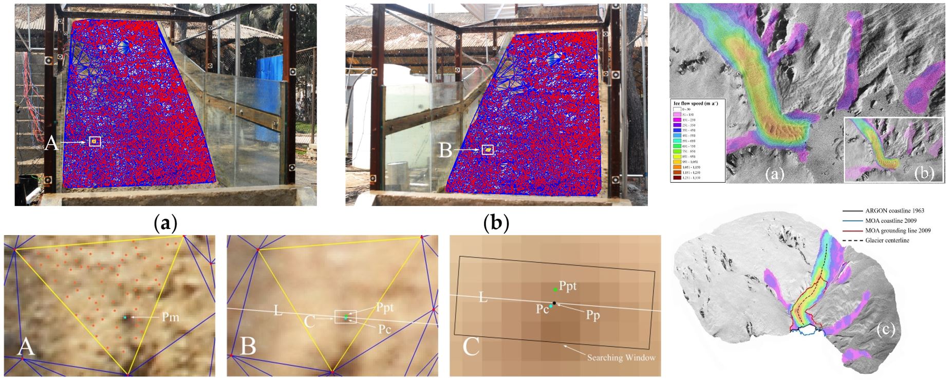
2. 弱紋理遙感影像的密集匹配方法研究:開發了集影像增強、金字塔分層、多條件約束的影像特征和格網匹配新方法,實現了弱紋理影像的密集匹配,應用于滑坡災害立體監測;開發了基于視差分解的早期影像密集匹配新算法,應用于南極冰川三維測圖;成果發表于Remote Sensing和IEEE Transactions on Geoscience and Remote Sensing等國際期刊。
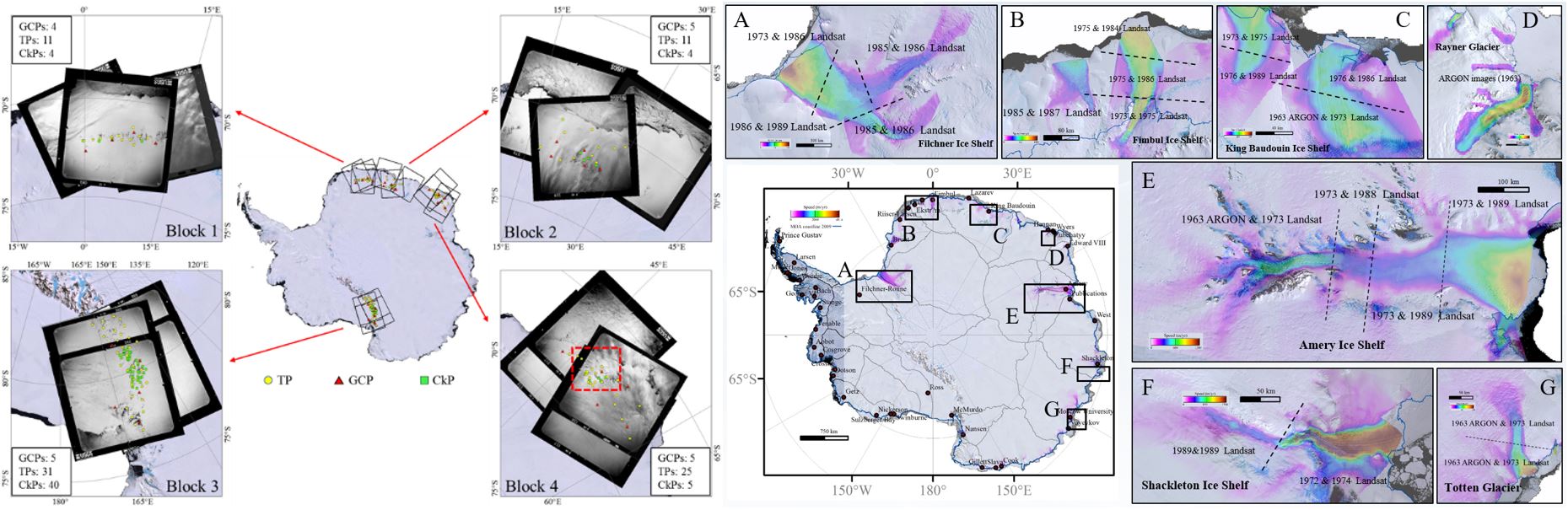
3.1960年代解密膠卷衛星影像的現代化攝影測量與南極冰流速度制圖:提出了1960年代早期膠卷衛星影像的現代化攝影測量建模新方法,研制了1963年東南極典型區域冰流速度圖,將國際上南極冰蓋研究時間尺度向前拓展了30年;成果發表于Photogrammetric Engineering and Remote Sensing期刊。
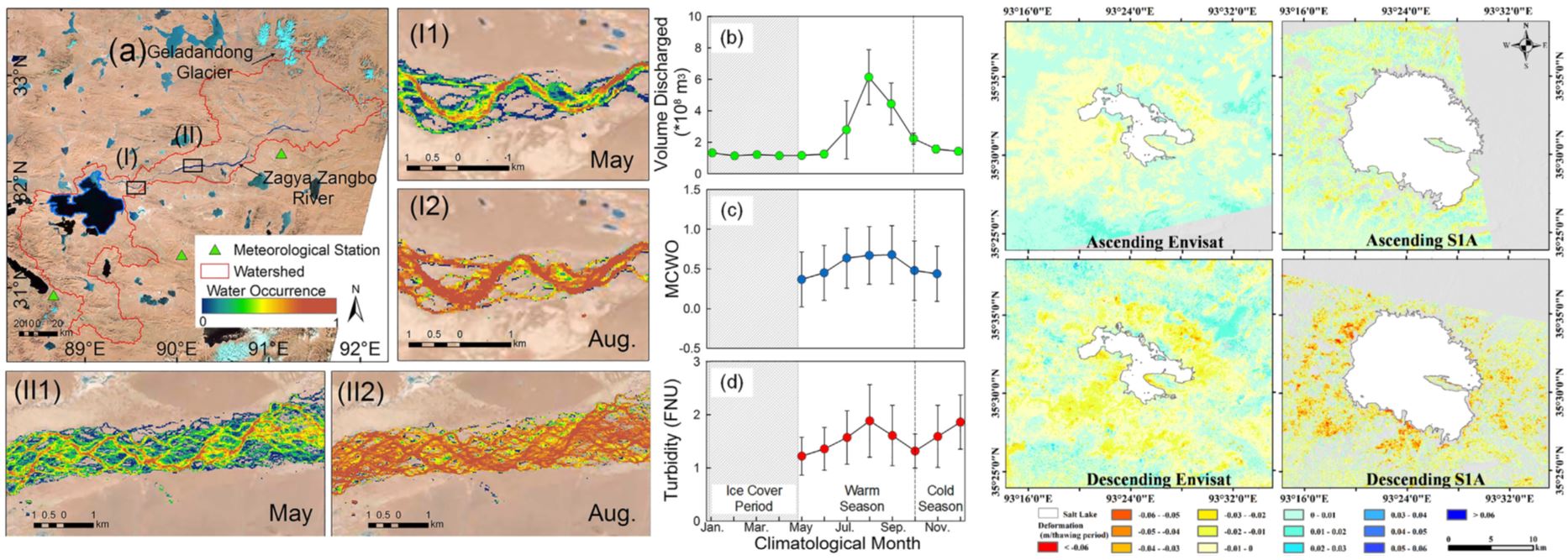
4. 青藏高原湖泊遙感與全球變化研究:探明了青藏高原大型湖泊水質變化特征及其驅動機制,揭示了湖泊持續擴張對于永久凍土退化的加速作用及對氣候變化的脆弱性響應;成果發表于Remote Sensing of Environment和Science of the Total Environment等國際期刊。
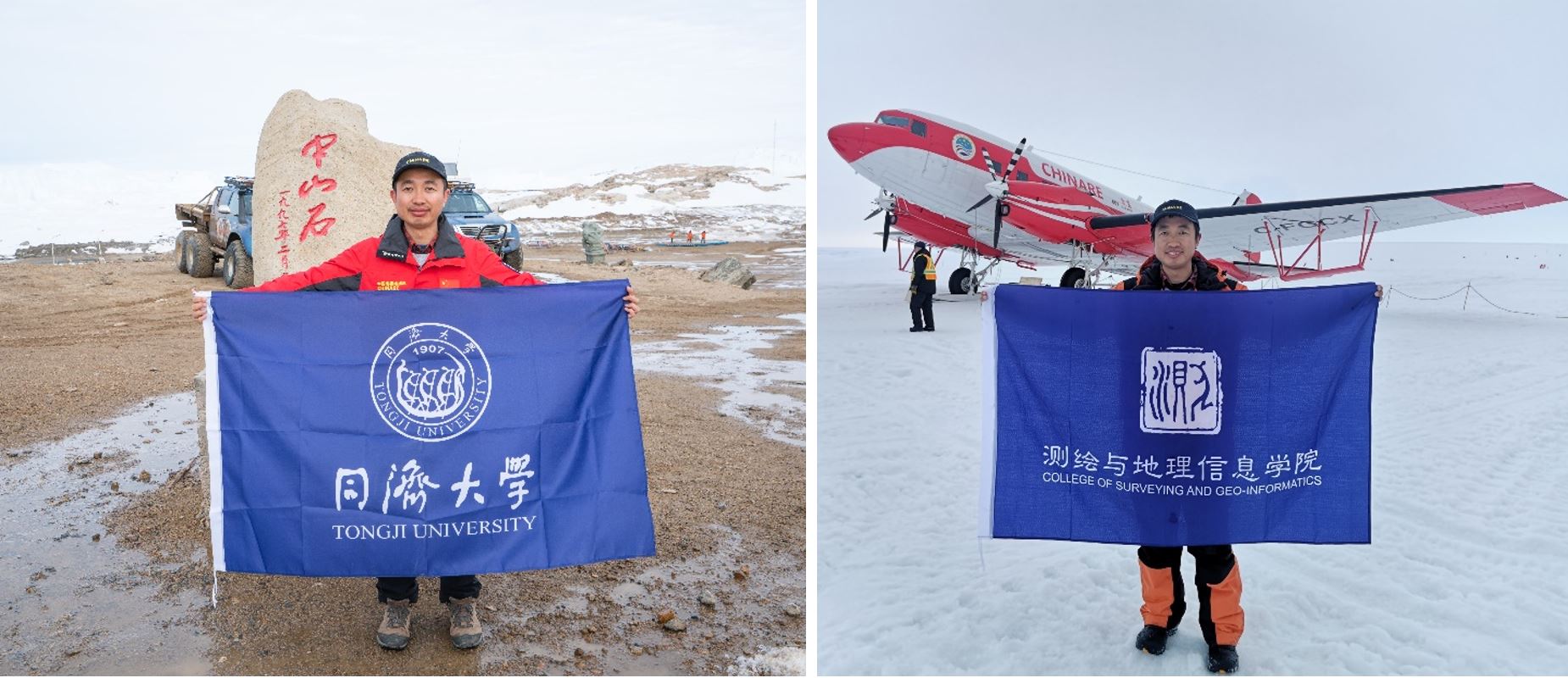
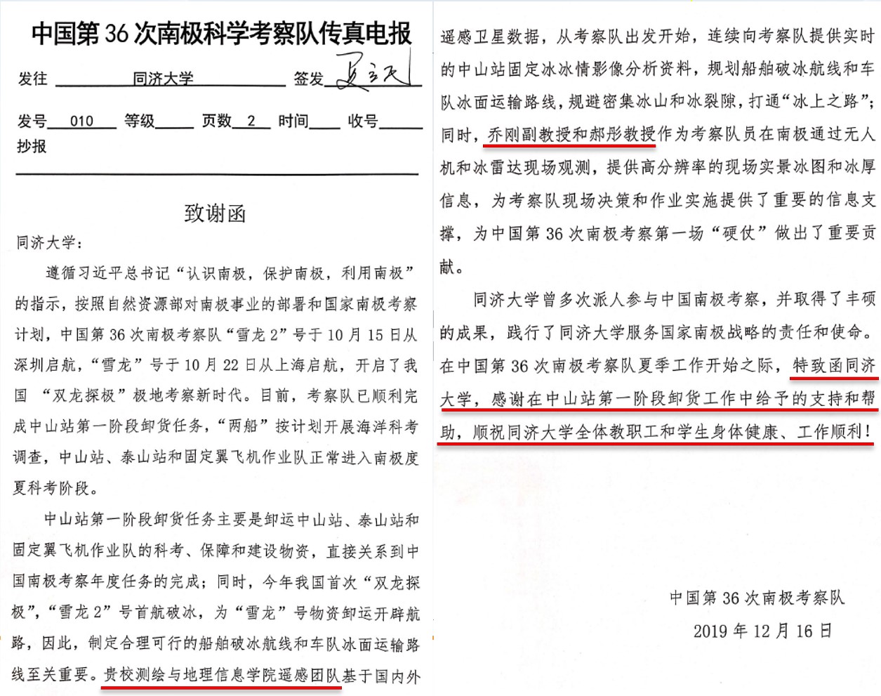
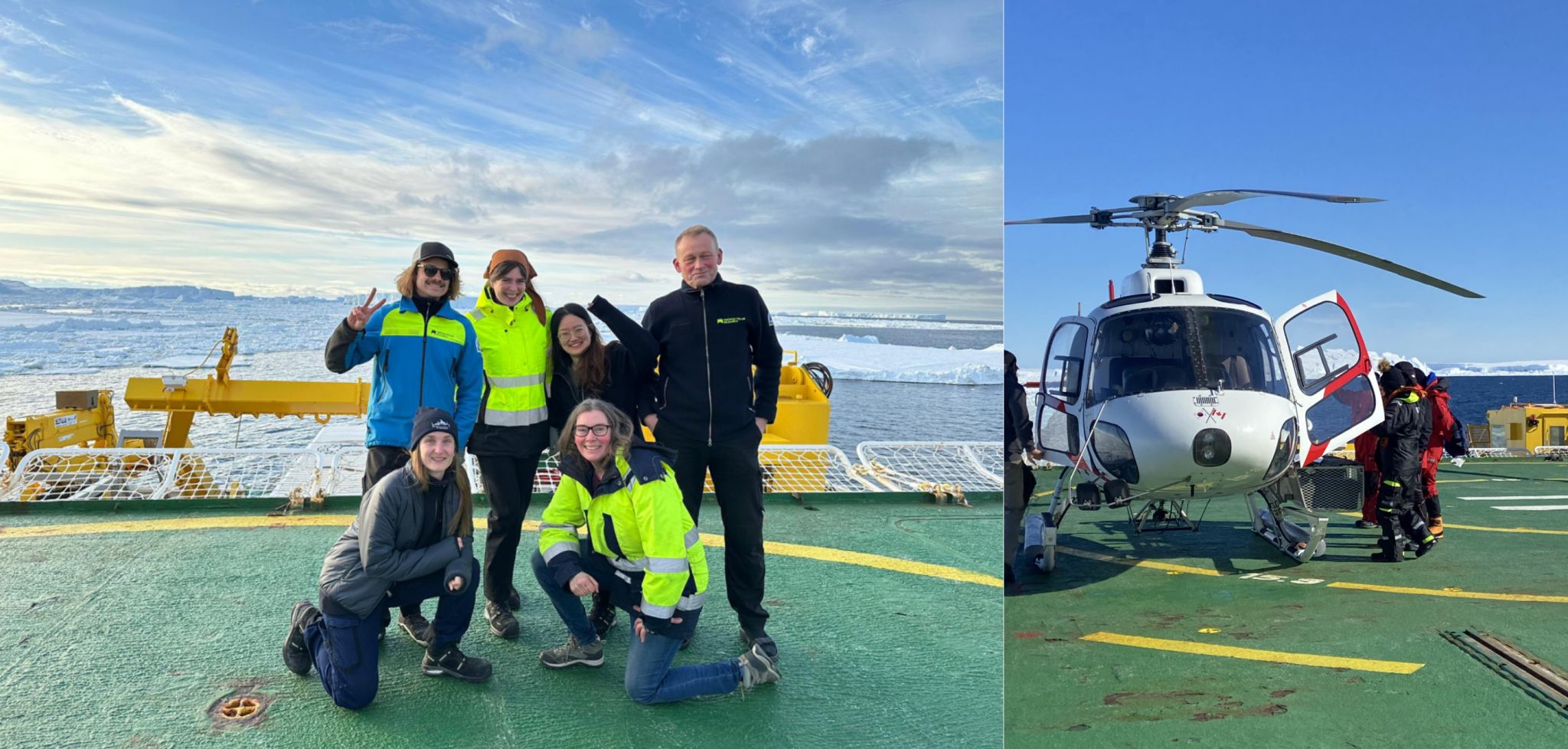
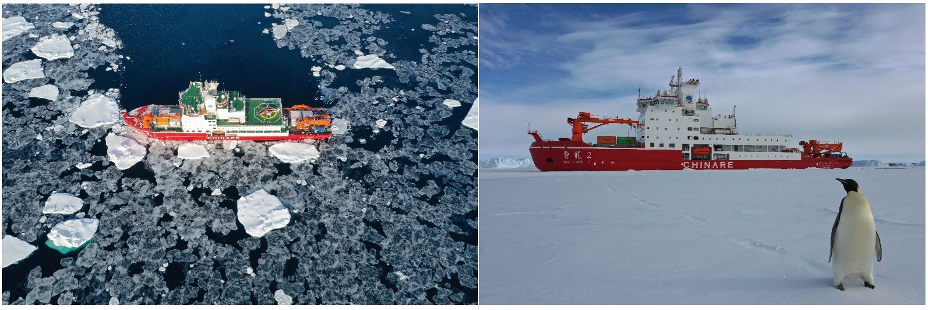
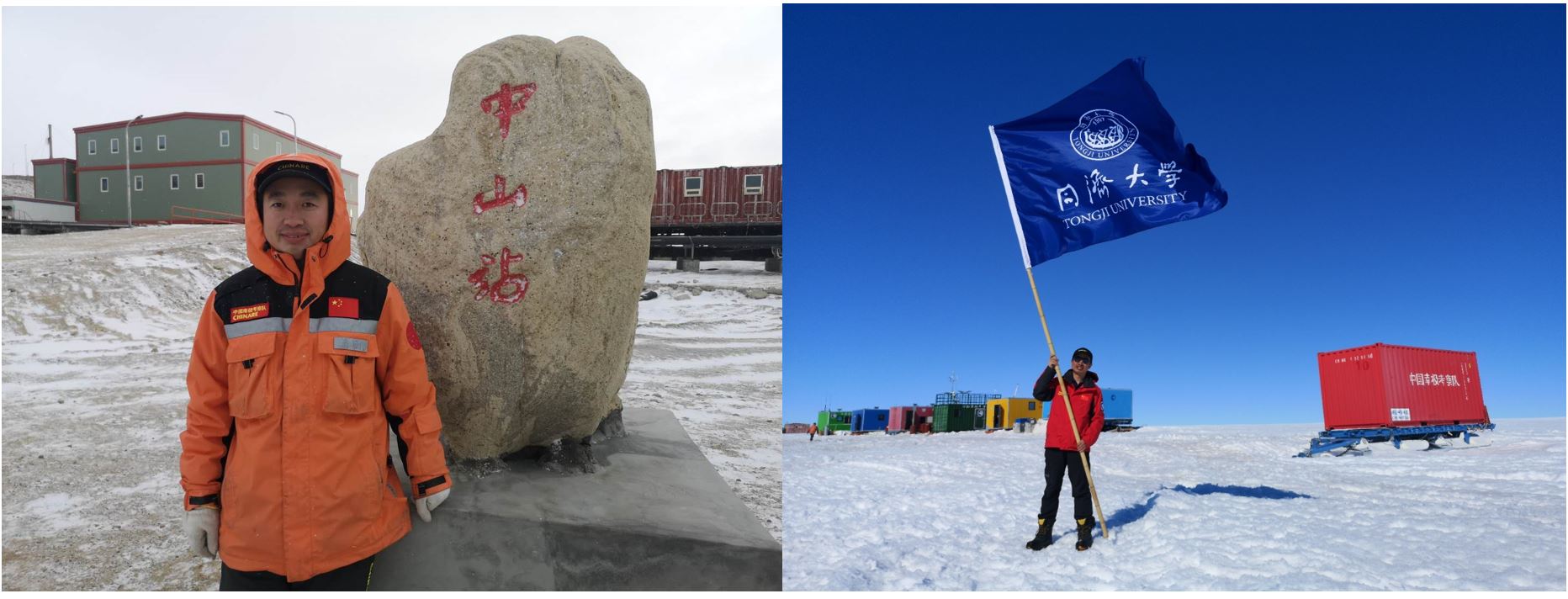
5. 極地科學考察 1)喬剛教授參加中國第35、36次南極科學考察 喬剛教授于2018-2020年間參加中國第35、36次南極科學考察,服務于國家南極戰略和極地科普事業。第36次南極科學考察中山站卸貨期間,依托近20期六合彩結果 遙感團隊為雪龍船規劃破冰航線和冰面運輸路線提供技術支撐并做出了重要貢獻,考察隊專門致函感謝同濟大學的支持,本人被中國第36次南極考察隊授予“優秀黨員”稱號。同濟大學官網、人民日報海外版、搜狐網、澎湃新聞等新聞媒體對南極科考活動進行了廣泛報道,獲得了公眾的廣泛關注。
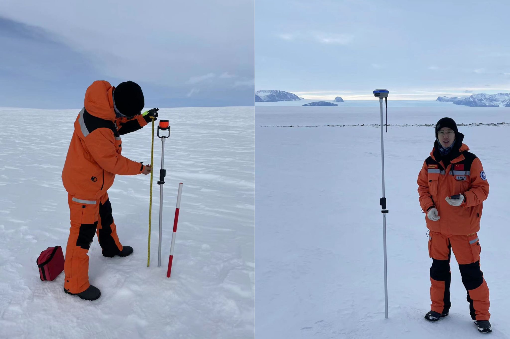
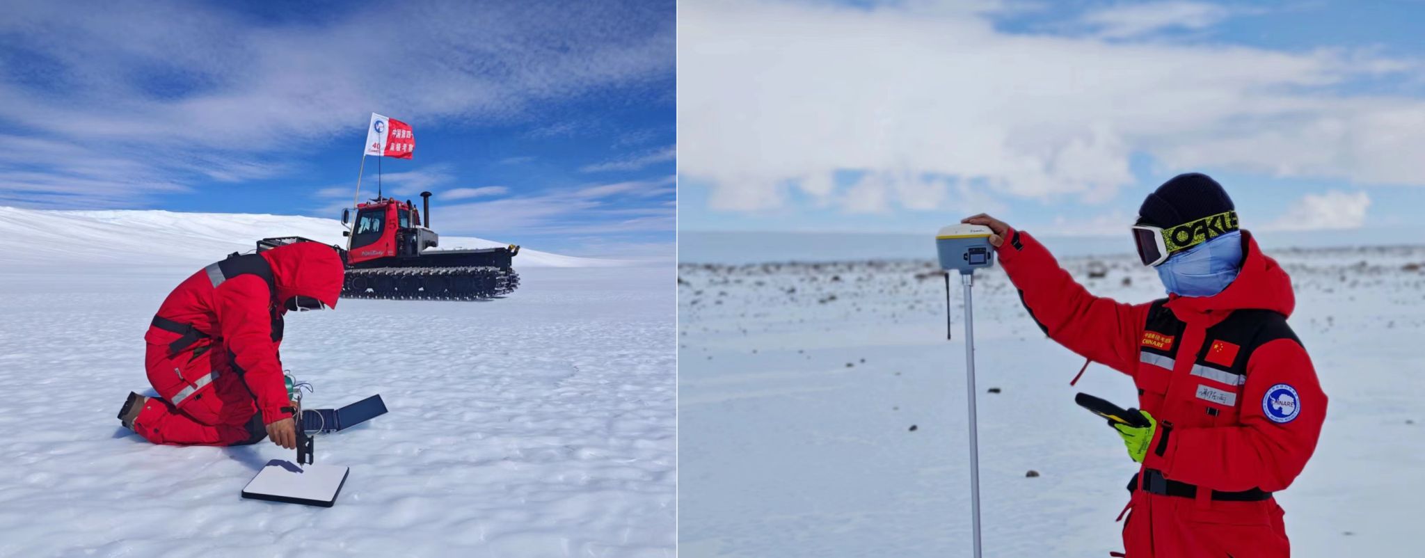
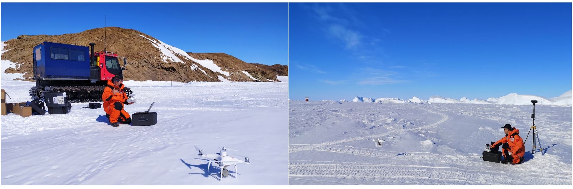
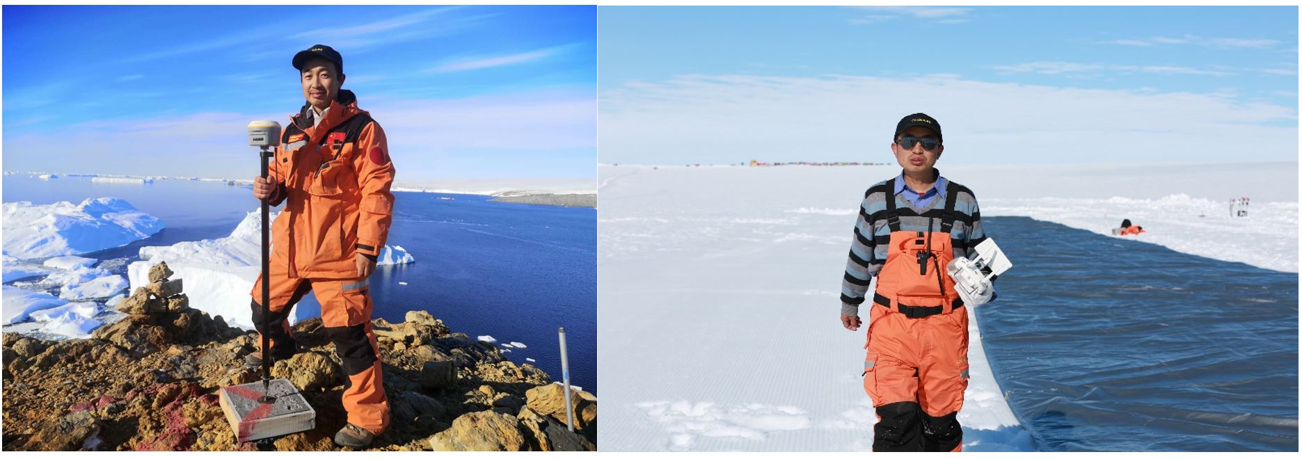
2)博士生李洪偉參加中國第38次南極科學考察 博士生李洪偉于2021-2022年間參加中國第38次南極科學考察,開展南極冰蓋邊緣區域ICESat-2冰雪表面高程測量精度評估工作,為精確估計南極冰蓋物質平衡對海平面上升貢獻提供數據支撐。在中山站區域,基于機載光學、雷達以及熱紅外傳感器,對拉斯曼丘陵內拉灣海冰、冰裂隙、熔池以及冰山進行動態觀測,安裝維護了20米冰雪溫度鏈,開展了南極冰蓋物質平衡關鍵參數觀測,對驗證極地數據產品精度起到了重要支撐作用。
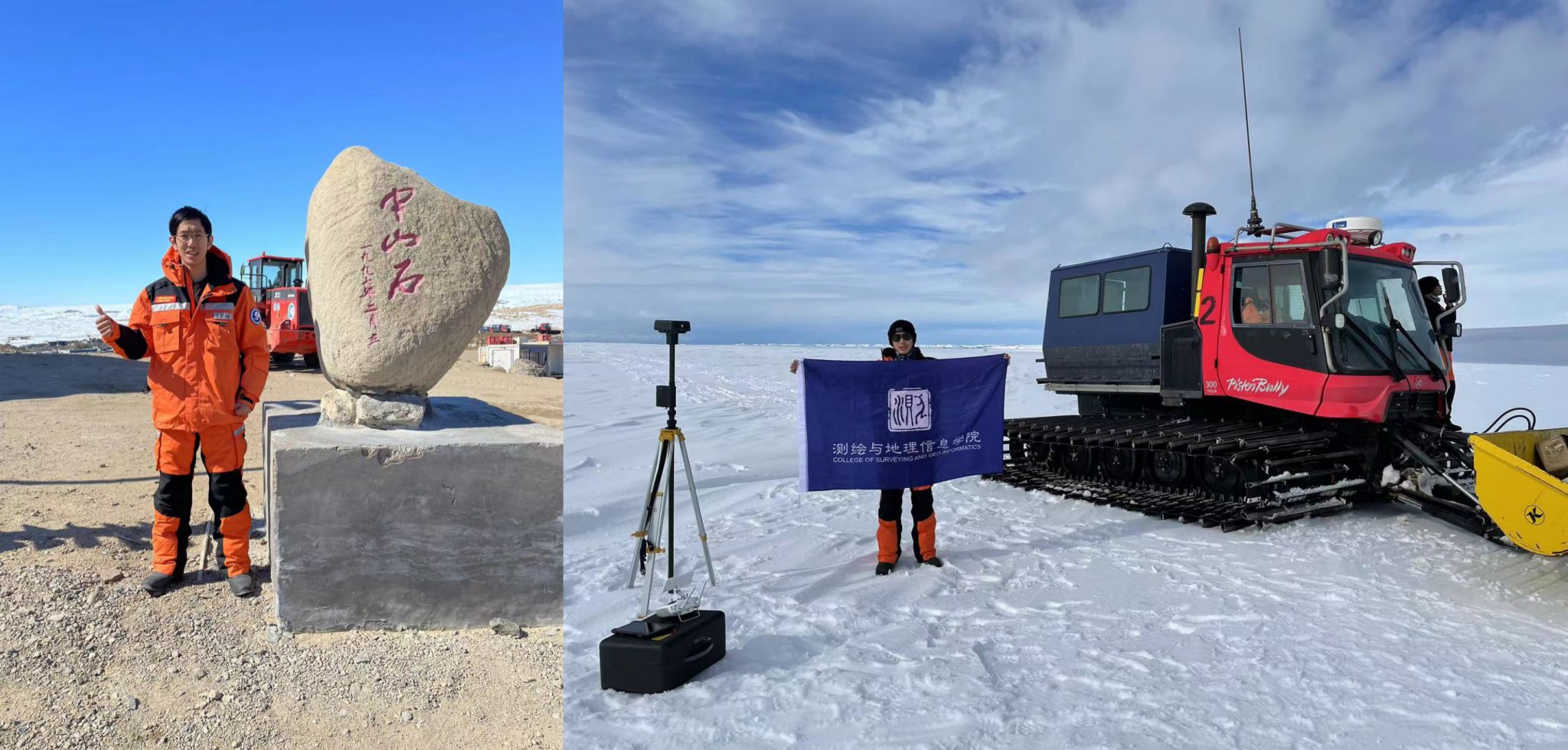
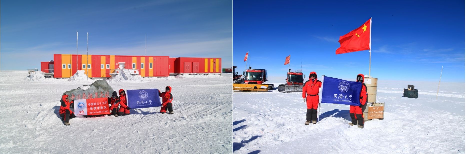
3)碩士生曹哲毅參加中國第39次南極科學考察 碩士生曹哲毅于2022-2023年間參加中國第39次南極科學考察,深入南極冰蓋內陸1200千米,參與開展中山站-泰山站-昆侖站內陸沿線南極冰蓋物質平衡與海平面上升貢獻研究的地空觀測。在中山站、昆侖站等周邊區域,曹哲毅完成多項業務化觀測項目,同時利用無人機平臺對冰面微地形進行探測、分析與建模,為提取冰蓋物質平衡與全球海平面變化關鍵參數提供基礎。返校后受到同濟大學官方公眾號、青春上海、光明日報等媒體采訪,其南極科考事跡展示了同濟學子的家國情懷和使命擔當。
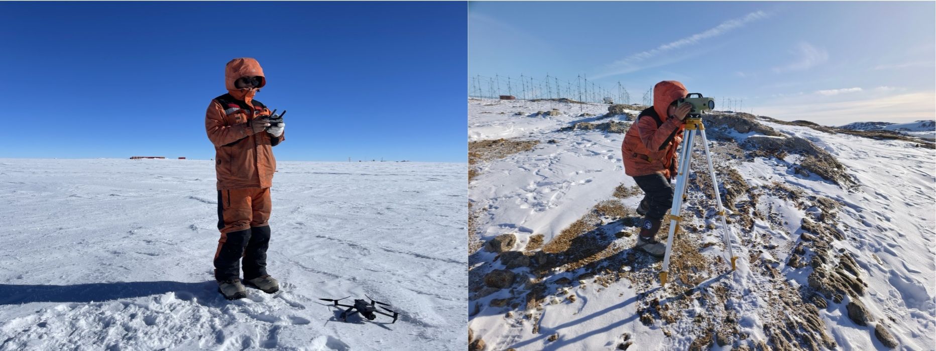
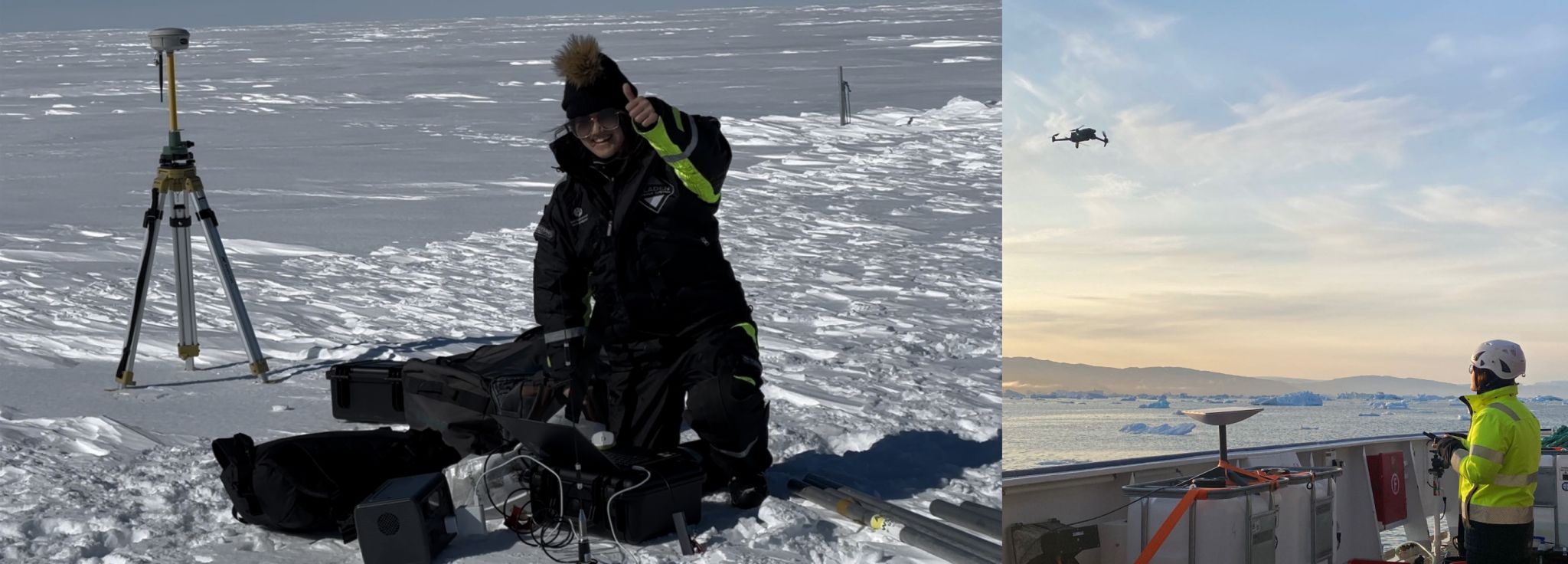
4)博士生謝陳雨參加中國第40次南極科學考察 博士生謝陳雨于2023-2024年間參加中國第40次南極科學考察,作為首位“00后”內陸隊員,前往南極內陸格羅夫山地區,針對物質平衡關鍵參數及冰雪表面特征進行高精度測繪研究。考察期間,開展高精度無人機航空攝影測量,聯合全波段地面光譜儀與光學衛星及無人機同步測定冰雪表面光譜曲線,通過地面及低空冰雷達探測冰雪淺層結構特征,基于高精度GNSS測量冰雪表面三維坐標等科學研究。基于國產高分辨率遙感衛星數據對格羅夫山地區行進路線以及麒麟冰下湖探路選線提供技術支持,為考察隊安全行進做出了貢獻。
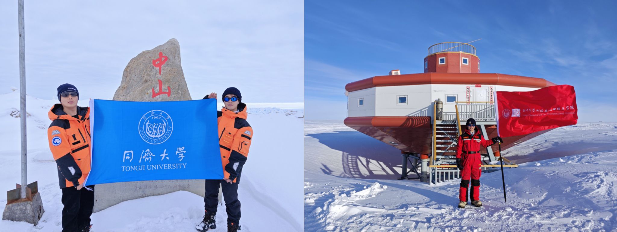
5)博士生袁小涵參加瑞典北極格陵蘭科學考察和韓國ARAON科考船多國(瑞典)南極科學考察 博士研究生袁小涵在赴瑞典哥德堡大學聯合培養期間,于2023年7月參加了瑞典哥德堡大學北極格陵蘭科學考察,并于2023-2024年參加了韓國ARAON 科考船多國 (瑞典) 南極科學考察任務,聚焦于國際上格陵蘭冰蓋和南極冰蓋冰-海熱點區域(東格陵蘭Sermilik峽灣Helheim冰川、西南極阿蒙森海Thwaites冰川、Dotson冰架等),開展在全球氣候變化背景下的冰川前緣及冰腔內部海洋環境調查和冰川冰架的高分辨率建模及演化分析,探究冰川與海洋相互作用,服務于未來南北極典型區域冰川冰架結構的穩定性評估,及其穩定性變化對未來海平面上升貢獻的預測。
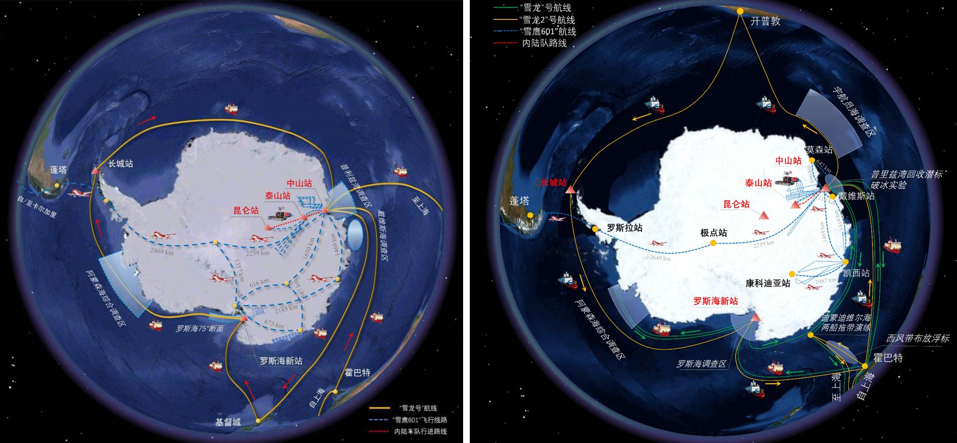
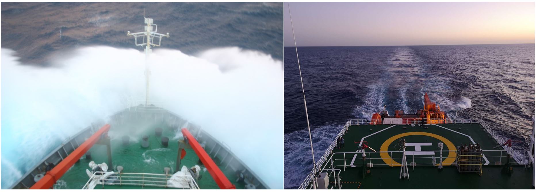
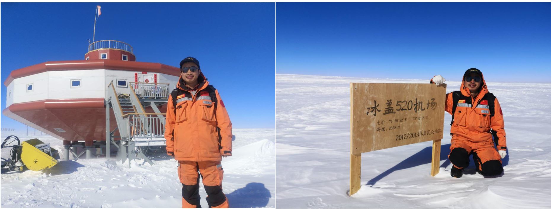
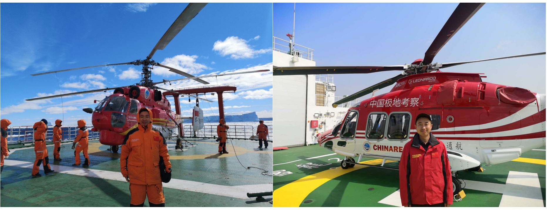
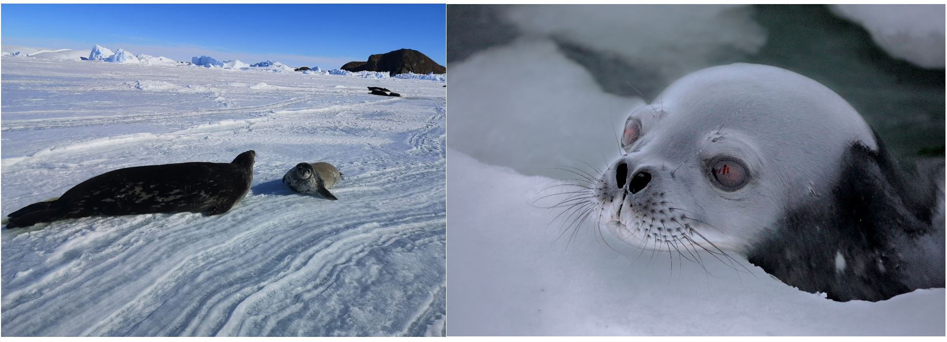
6. 中國第35、36次南極科學考察掠影 中國第35、36次南極科學考察航線
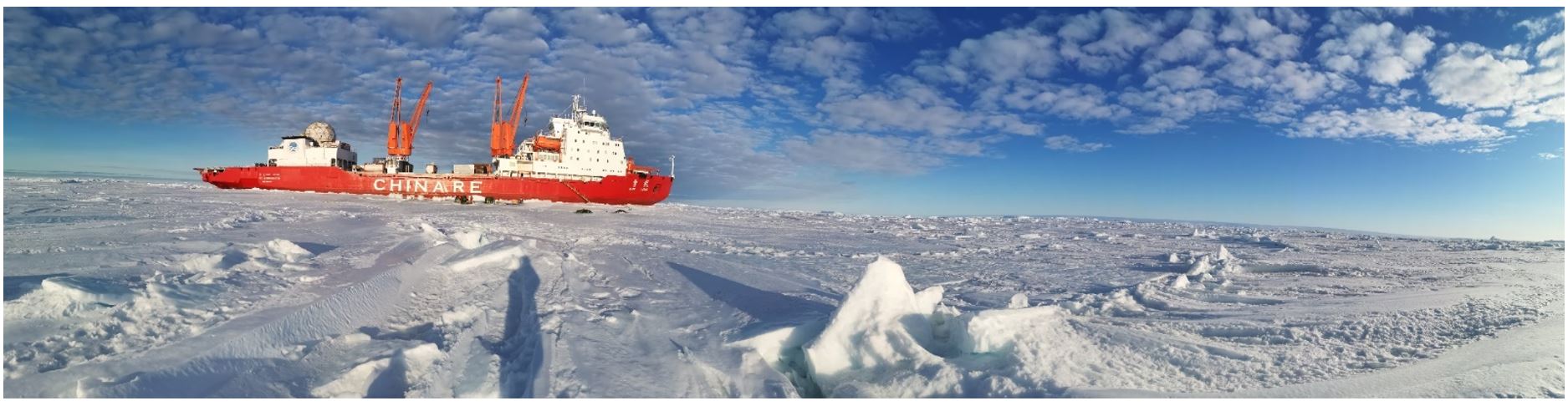
“雪龍”號、“雪龍2”號科考船南行
南極“海冰探路”與冰蓋測繪
中山站與內陸出發基地
泰山站與“冰蓋520機場”
“KA32”直升機與“海豚”直升機
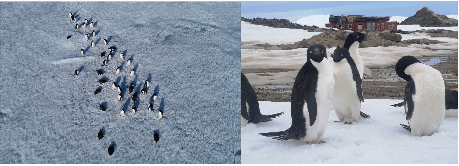
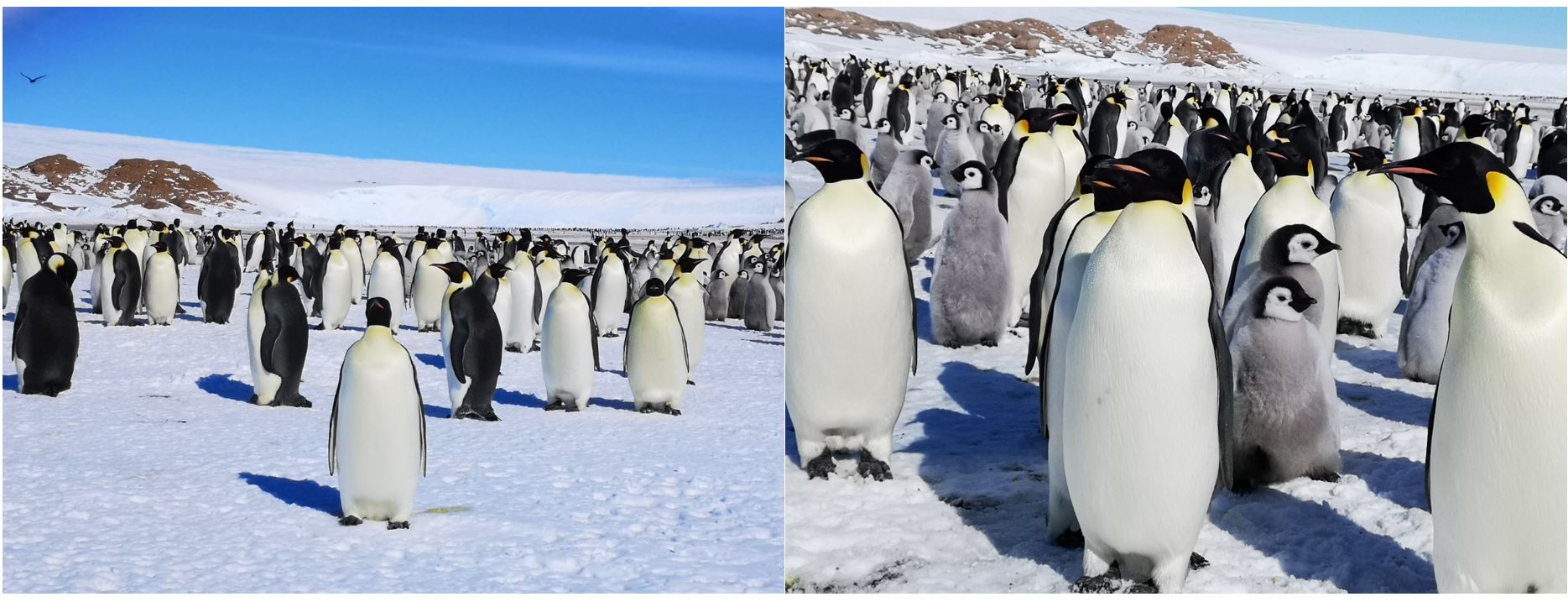
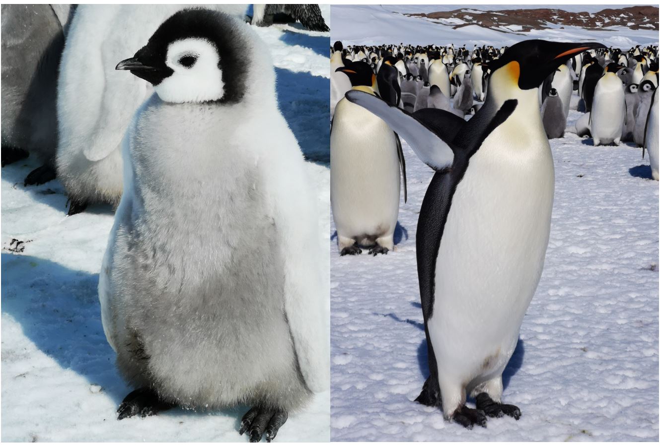
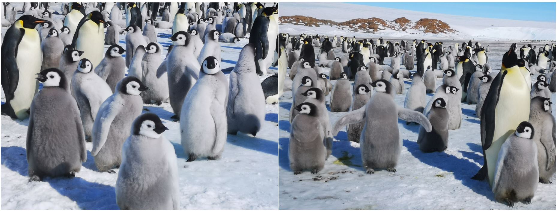
海豹與企鵝
|
|